Randonnée 15393 La rando Voconçoise - Provence-Alpes-Cote-D'Azur, Vaucluse (84)
Rando proposée par: Le Voconce
Cette page a été affichée 4722 fois.

Type
Boucle

Distance
7.3 Km

Altitude maxi
447 M

Altitude mini
225 M

Durée
2h30 min

Difficulté
facile


Balisage
Non

Accès
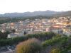
Crestet Vaucluse (84)

Départ
Camping Le Voconce

Dénivelé
270 M

Référence carte
3040ET Série bleue IGN
| Photos | Type | Titre |
|---|---|---|
 |
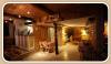
Chambre d'hôtes | Le Chat sur le Toit |
 |
Chambre d'hôtes | La Maison d'Hôtes de Villedieu |
 |
Chambre d'hôtes | Chalet Ventoux Serein |
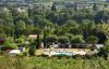 |
Camping | Le Voconce |
 |
Chambre d'hôtes | Patio des Vignes |
 |
Hôtel, Auberge | La Bastide Bleue |
 |
Camping | Camping des Favards |
 |
Chambre d'hôtes | L'Evéché |
 |
Gîte | La Ferme du Subion |
 |
Gîte | A la Ferme |
| Photos | Nom | Présentation |
|---|---|---|
 |
Muséum d'Histoire Naturelle Harmas de Fabre | Ce domaine d’un hectare est situé dans le village de Sérignan du Comtat, à 30 km d’Avignon. Il comprend toujours un mas et une terre en friche : "l’harmas", en provençal. Au milieu des aubépines, groseilliers sauvages, romarins et lavandes, adonnez-vous sans compter à ce qui fut l’activité préférée... |


Météo
Impossible de charger les données météorologiques.
CLIQUEZ ICI pour enregistrer votre randonnée