CLIQUEZ ICI pour enregistrer votre randonnée
Recherche par type de randonnée
| Photos | Nom | Type | Difficulté | Distance | Ville | Département |
|---|---|---|---|---|---|---|
 |
Le rocher de Pène Blanque | Boucle | Difficile |
13,0 Km |
Arbas | Haute-Garonne (31) |
 |
Randonnée Mauvezinoise | Boucle | Moyenne |
12,0 Km |
Mauvezin | Haute-Garonne (31) |
 |
Randonnée Luchon - Le Lac Celinda | Boucle | Difficile |
13,0 Km |
Castillon-de-Larboust | Haute-Garonne (31) |
 |
Les Moulins de Vaux | Boucle | Moyenne |
15,3 Km |
Maurens | Haute-Garonne (31) |
 |
Chemin des Fourches | Boucle | Moyenne |
5,3 Km |
Saint-Félix-Lauragais | Haute-Garonne (31) |
|
|
Le Ru d'Enfer | Boucle | Facile |
5,0 Km |
Bagnères-de-Luchon | Haute-Garonne (31) |
|
|
GR 10 - De Bagnères-de-Luchon à Artigue | Grande randonnée | Difficile |
8,0 Km |
Bagnères-de-Luchon | Haute-Garonne (31) |
 |
Randonnée Hospice De France - Le Pic de Sacroux | Aller-retour | Difficile |
19,0 Km |
Bagnères-de-Luchon | Haute-Garonne (31) |
|
|
Du Tarn au Frontonnais | Boucle | Facile |
10,9 Km |
Villemur sur Tarn | Haute-Garonne (31) |
|
|
Le Pic de Cagire | Boucle | Moyenne |
11,0 Km |
Boutx | Haute-Garonne (31) |
|
|
GR 10 - D'Artigue à Fos | Grande randonnée | Difficile |
21,1 Km |
Artigue | Haute-Garonne (31) |
 |
Boucle de Larra sud | Boucle | Moyenne |
9,9 Km |
Larra | Haute-Garonne (31) |
 |
Le Lac de Saint-Férréol | Boucle | Facile |
4,7 Km |
Revel | Haute-Garonne (31) |
|
|
Pic de l'Escalette | Aller-retour | Facile |
5,0 Km |
Boutx | Haute-Garonne (31) |
|
|
Chemin de la Pergue | Boucle | Moyenne |
10,0 Km |
Revel | Haute-Garonne (31) |
|
|
Le Canal de Franquevielle | Boucle | Moyenne |
17,1 Km |
Cardeilhac | Haute-Garonne (31) |
|
|
Chemin de la Lande | Boucle | Facile |
9,8 Km |
Roumens | Haute-Garonne (31) |
 |
Le Lac Bleu (Bagnères) | Aller-retour | Difficile |
17,0 Km |
Cazeaux-de-Larboust | Haute-Garonne (31) |
 |
Randonnée Cirque de Crabioules | Aller-retour | Difficile |
19,4 Km |
Luchon-Superbagnères | Haute-Garonne (31) |
 |
Saint-Bertrand-de-Comminges | Boucle | Facile |
10,5 Km |
Saint-Bertrand-de-Comminges | Haute-Garonne (31) |
 |
La Pointe de Litérole | Aller-retour | Difficile |
25,0 Km |
Oô | Haute-Garonne (31) |
 |
Lac des Boums du Port | Aller-retour | Très Difficile |
10,8 Km |
Bagnères-de-Luchon | Haute-Garonne (31) |
|
|
La Vallée du Larboust | Boucle | Moyenne |
13,5 Km |
Castillon-de-l'Arboust | Haute-Garonne (31) |
|
|
GR 10 - De Fos à l'Etang d'Araing | Grande randonnée | Difficile |
18,6 Km |
Fos | Haute-Garonne (31) |
 |
Randonnée Maurens - Chemin de l'âne | Boucle | Facile |
14,8 Km |
Maurens | Haute-Garonne (31) |
Pages
Recherche par département ou par pays
Alsace
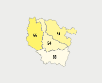
Basse-Normandie
Champagne-Ardennes
Franche-Comté
Haute-Normandie
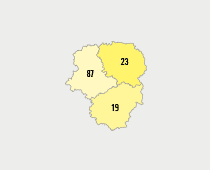
Ile-De-France
Languedoc-Roussillon
Limousin
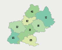
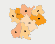
Midi-Pyrénées
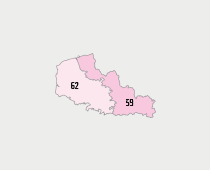
Nord-Pas-De-Calais
Pays-De-La-Loire
Picardie
Poitou-Charentes
Provence-Alpes-Côte-D'Azur
Rhône-Alpes
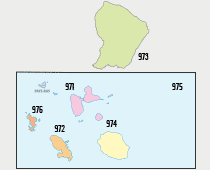
Dom-Tom
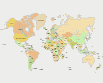
Monde
CLIQUEZ ICI pour enregistrer votre randonnée